Google Maps’ popular feature Street View is now officially in the Philippines, with areas in Intramuros already published.
Google partnered with the Department of Tourism to begin Street View project in the country.
Now already available in 50 countries, Street View allows people to virtually explore cities on Google Maps through 360-degree photographs taken at street level.

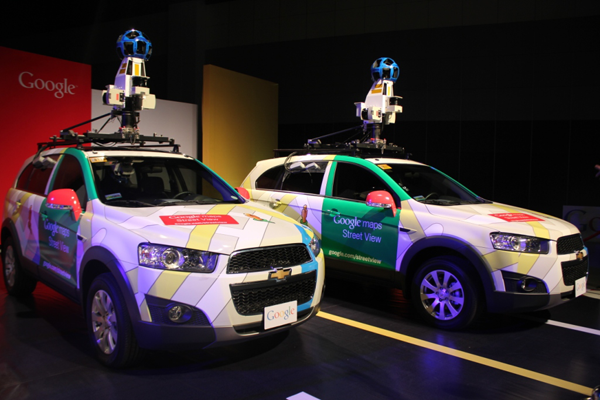
Google Philippines Country Marketing Manager Ryan Morales and Tourism
Secretary Ramon Jimenez, Jr. unveil the Street View cars.
Starting in the city of Manila, Google will drive colorful Street View cars equipped with special cameras to collect panoramic imagery of the Philippines. From there, the cars will continue across the country to capture more imagery.
Google has already started publishing Street View panoramas of four sites at Intramuros: San Agustin Church, Baluarte de San Diego, Plaza San Luis Complex and Fort Santiago.
These 360-degree photos were collected using the Street View Trekker, a wearable backpack camera system that is part of the Street View fleet.
Google plans to use the Trekker, along with the Street View Trolley, a pushcart camera system, to capture more of the Philippines’ off-road, natural and indoor destinations.
Google hopes Street View will provide Filipinos with different ways of exploring favorite and new local spots as well as more relevant and useful online map services.


